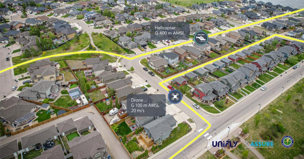
Advanced NOTAM Parsing transforms complex, text-based Notices to Airmen (NOTAM) into clear, information for UAS and UAM operations. By decoding every line with a language processor and not just relying on basic Q-line, it presents airspace restrictions with unmatched precision, ensuring drone pilots navigate safely and comply with up-to-date airspace information.
TRUSTED BY INDUSTRY LEADERS
Previous
Next
Complexities in interpreting Legacy ICAO NOTAM
Complexity and Inaccessibility
Traditional ICAO NOTAM, crucial for flight safety, are often complex and difficult for drone pilots to interpret.
Risk of Misinterpretation
Simplistic parsing methods may overlook critical details, increasing the risk of non-compliance and airspace violations.
Lack of Granularity
Basic parsing fails to capture the precise geometry of restricted areas, leading to potential safety hazards and operational inefficiencies.
Unifly's Solution to Advanced NOTAM Parsing Challenges
For NOTAMs not tied to existing airspaces, it autonomously generates specific volumes, ensuring drones avoid areas like large events in uncontrolled airspace.
Provides drone operators with accurate, easy-to-understand NOTAM information, significantly enhancing situational awareness and regulatory compliance.
These methods not only enable us to effectively manage remote ID and adhere to all safety and regulatory standards, but more importantly, it ensures that obtaining remote ID is streamlined and accessible through a variety of means available.
Products used within the solution
FOR DRONE AND UAM/AAM OPERATORS
Explore: Offers drone operators easy to understand NOTAM visualization.